| Index
|
Market Square
|
|
Postcard, printed in Saxony and published by
Stewart & Woolf, London, E.C., c.1910
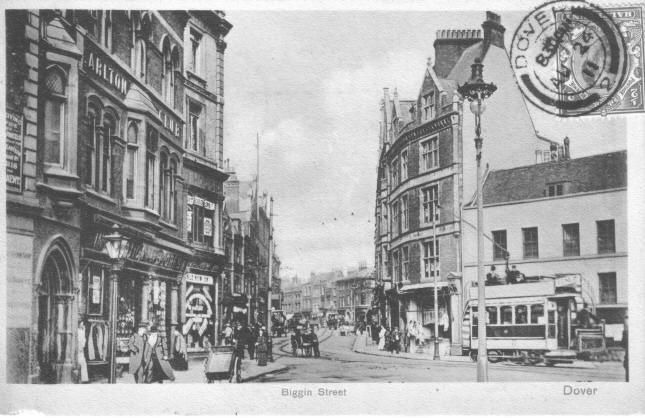
The postcard above, incorrectly titled "Biggin Street,"
shows the view of the corner of Market Square looking up Cannon Street, with
the start of Biggin Street in the distance. Luckily the stamp, stuck
on the wrong side, and postmark, do not in any way obscure the picture.
This card was posted in Dover at 8.30pm on 24th August 1911, addressed to a
"Mlle Valerie Daniel, 26 Rue Wellington, Ostende, Belgium. "
On the left of the picture can be seen the International
Stores, with the Carlton Club above. The sign on the wall on the first
floor is advertising a "Receiving Office for ... Parcels" for the South
Eastern & Chatham Railway. The shop behind, which is not yet
identified (part of Waterloo House, on the corner of Market Street), is
having a sale; the banner in the first-floor window announcing "Great
Bargains". The tram carries an advertisement for Leney's, the local
brewery in the Pier District. |
"... there is no doubt that the Market Place owes its origin to St.
Martin's Fair. This annual gathering, established by Royal grant
about the year 1160, was held in the Market Place, which was then St.
Martin's Churchyard. In the first instance, this fair was mainly of
a religious character, in honour of the Patron Saint, but, subsequently,
merry-making and trafficking became its chief features. To denote
its religious origin, a cross seems to have been set up, round which the
people congregated, and in later days that pillar became the Market Cross.
That Market Cross fell into ruin or was destroyed during the time of the
War of the Roses, and in the year 1479 the Corporation, with the consent
of the Prior, decided that a new cross should be set up at 'Cross Place,'
and that the common market should be kept there henceforth. That
intention was not carried out, but when the Priory was dismantled in 1540,
the Corporation, without any authorisation, entered into full possession
of the Market Place area." (J.B.J. 1907)
|
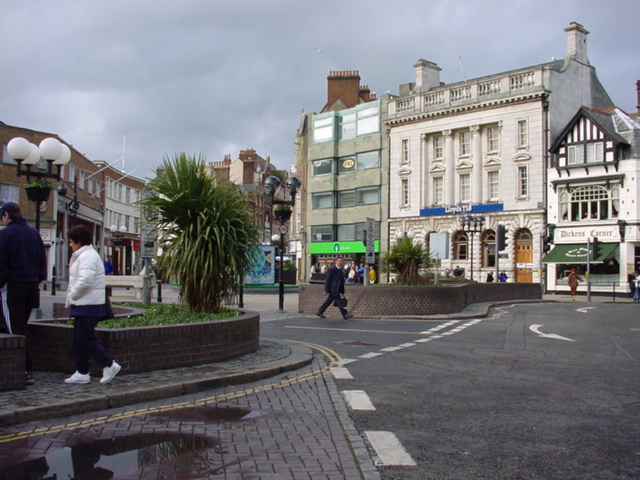 |
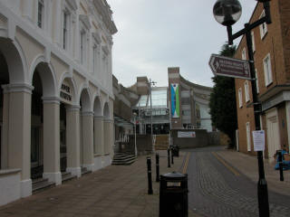
The picture above shows the modern view of the Market Square from the junction with King
Street looking towards Cannon Street.
"About a century or more after the Norman Conquest, there came into
existence, on the north side of the Market Square, as old Dover deeds
describe it, 'The Church and Cemetery of the Blessed Peter of Dover.'
There is no description or drawing left to indicate what St. Peter's
Church was like, but a few samples of its sculptural stones were found in
clearing the site for Lloyds Bank, and they point to its origin being the
close of the 11th century. There are only three references to this
church, as far as we know, in the Dover Corporation deeds... This
church, from 1367 until 1581, was used as the place where members of
Parliament and the Mayors of Dover were elected, and from its tower the
curfew bell was rung. In the year 1581 the church appears to have so
fallen into ruin that it could not be used, and St. Mary's in its stead
became the parish church. Queen Elizabeth, some time prior to the
year 1584, made a grant of the church to the Mayor and Jurats to be sold
to raise money to repair the harbour. An accusation was made, in
1584, against Thomas Allen (formerly Mayor), of not having accounted for
the money derived from the sale of the property of St. Peter's Church,
and, in consequence, he secretly left the town. A great many of the
leading men of Dover were buried in the chancel of St. Peter's, the latest
recorded being in the year 1572." (J.B.J.
1907)
|
 |
|
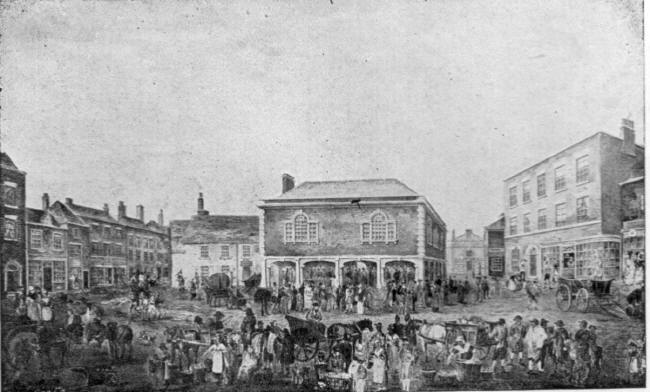
The Market Square, as an open space, is comparatively modern. From
1605 to 1861, the central part of the square was occupied by the old
Guildhall. This view from 1822, was drawn from the north side of the
square.
In Roman times, the sea came right up to this area, with ships dropping
anchor in the shelter of the surrounding hills. |
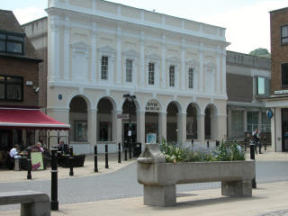 |
This impressive frontage was once part of the old Dover
museum. After suffering war damage it was repaired and used as a
covered market (the museum was moved to the basement of the Town Hall) until, as part of the recent redevelopment of the area, the
building was demolished and the frontage incorporated into a new building,
now once again used as a museum. |
| At the top of the lane is the new public library and adult
education centre. To the right, behind the tree, is a part of the
ruins of St Martin-le-Grand church; the library and the York Street bypass
have been built over much of the remains of the church and graveyard. |
 |