|
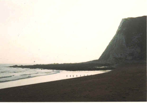
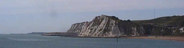
Shakespeare Cliff in the 1960s
Compare this picture, taken in the 1960s, with the one at the top: see how the brow of
the cliff has fallen into the sea. Also, when this picture was taken, it was
possible to walk around the shoreline to the Warren at low tide.
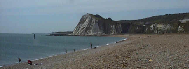
Shakespeare Beach is the stretch of shingle beach to the west of Dover Harbour, from
the Admiralty Pier to Shakespeare Cliff. As a child, I used to climb over the hills
on the right of the picture, down the steps and across the footbridge (not discernable in
the picture) over the railway line to paddle in the sea.
At the top of the steps was a little shop where we would buy ice-creams and drinks; it
was demolished a few years ago to make way for the new A20 road to Folkestone.
At the end of the day we would trudge along the beach to the level crossing by the
pier. From there we would catch a bus home.
The level crossing is no more (the trains no longer go to the Marine Station). No
buses go that way any more - the area is more or less derelict.
Beyond the cliff lies the Warren and Folkestone. The single pier that forms
Folkestone Harbour, and the town above it, can be seen in the background of the photos. |
|
Shakespeare Cliff gets its name from its association with
William Shakespeare:
"Come on, sir; here's the place: stand
still. How fearful
And dizzy 'tis to cast one's eyes so low!
The crows and choughs that wing the midway air
Show scarce so gross as beetles: half way down
Hangs one that gathers samphire, dreadful trade!
Methinks he seems no bigger than his head:
The fishermen that walk upon the beach
Appear like mice; and yond tall anchoring bark
Diminish'd to her cock; her cock a buoy
Almost too small for sight: the murmering surge,
That on the unnumber'd idle pebbles chafes,
Cannot be heard so high. I'll look no more;
Lest my brain turn, and the deficient sight
Topple down headlong."
King Lear, Act IV scene VI - The Country near Dover.
Both the cliff and the coastline have changed dramatically over the years.
Erosion has eaten away the cliff, producing falls of chalk. Man has had a far
greater effect on the coastline, with the building of the Channel Tunnel.
View from the old Town Station
In the pictures at the top and bottom of this page, the square
plateau at the base of the cliff is "Samphire Ho",
reclaimed from the sea by dumping the chalk excavated from the tunnel. It has been
landscaped to form a nature reserve. |
|
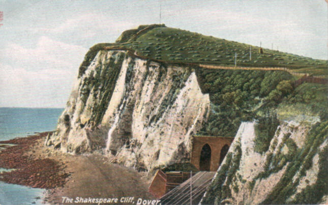
I cannot identify the date of this card, but the objects
on the cliff-top appear to be motor cars. Fencing has been erected
along the top of the cliff, which does not appear in the picture below.
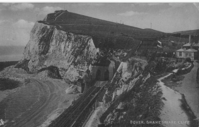
The postcard above was posted on the 9th September 1910.
It shows the dual railway tunnels through Shakespeare Cliff on the South
Eastern Railway line to Folkestone. There is clear evidence of cliff
falls around the headland. At the right of the picture, at the top of
the cliff, is "Sunny Corner", the home of the Langabeer family. Ray
Langabeer, alias Pigeon, wrote a book about his family and his early life
here. As children, when we used to climb over the Western Heights to
Shakespeare Beach, we would stop to buy sweets and fizzy drinks from
the small shop in his house, before going down the steps to the beach.
Behind here were the Coastguard Cottages in Old
Folkestone Road.
Shakespeare Cliff from the Admiralty Pier
|